Photo by Annie Spratt on Unsplash
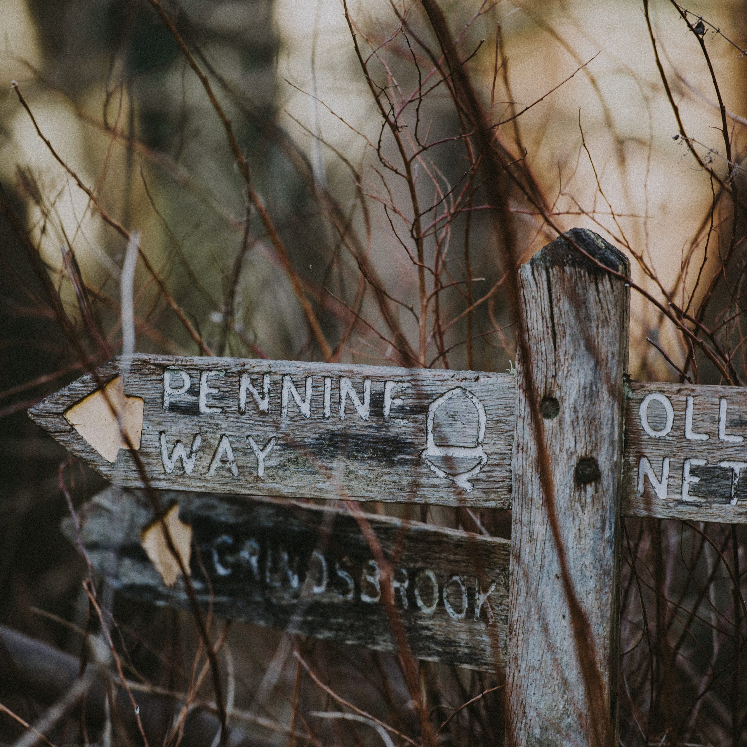
The renowned long-distance Pennine Way winds across the untamed Pennine Mountains for around 268 miles (431 kilometers) in England. It was founded in 1965 and offers hikers a challenging and spectacular journey across many environments, including moorlands, valleys, and historic cities.
The trail’s unique combination of natural beauty and cultural history has made it a popular destination for outdoor enthusiasts seeking an exceptional journey. About 150,000 hikers complete the Pennine Trail annually. Here are some things you need to know to be a part of it.
Brief History of Pennine Way
The Pennine Way was officially inaugurated on April 24, 1965, making it the first designated National Trail in the United Kingdom. Its history extends back to the middle of the twentieth century. Tom Stephenson, a journalist and outdoor enthusiast, was the first to propose creating a long-distance trail over the Pennine Mountains in the 1930s.
It was the first officially installed National Trail in the United Kingdom. Its historical significance and recognition among hikers have benefited from this early popularity. The Pennine Way has built a strong reputation among hikers, nature enthusiasts, and adventurers, drawing people worldwide to enjoy its challenges and rewards.
The sight in Pennine Way
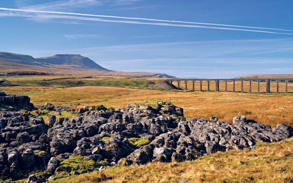
For nature lovers and thrill seekers, the Pennine Trail is a fascinating path that travels through the breathtaking landscapes of Northern England. This trail, which spans 429 kilometers (267 miles) of spectacular scenery, presents a unique chance to interact with nature while immersing oneself in the area’s rich history and culture.
The Pennine Trail is like walking into a real-life postcard. The voyage starts among the undulating hills and verdant meadows, where every bend exposes a different scene that is more enthralling than the last. You will pass by lovely villages, quaint market towns, and historical sites that witness the region’s colorful past as you travel through this picturesque area. The trail’s well-planned route will take you past historic woodlands, serene reservoirs, and harsh moorlands, each of which is attractive.
The trail’s varied flora and animals are among its most distinctive qualities. Nature lovers will savor the chance to see uncommon bird species, vivid wildflowers, and occasionally even grazing animals. From the colorful blossoms of spring to the flaming foliage of autumn, the changing seasons paint the environment in an ever-evolving palette. The Pennine Trail offers an unlimited variety of subjects for photographers and artists to record and preserve.
The Pennine Trail is a must-visit location for many reasons besides its stunning natural surroundings. The route passes through towns that have managed to hold onto their distinctive past, giving visitors a genuine look into the locals’ customs and way of life. Along the journey, charming taverns and warm inns provide opportunities to sample regional food and talk with locals and other travelers.
You can’t help but experience a strong sense of connection to the land and its inhabitants as you follow in the footsteps of earlier generations. The Pennine Trail promises a memorable experience that will leave an indelible stamp on your heart and spirit, whether you’re looking for a strenuous outdoor adventure, a peaceful escape from the hustle and bustle of daily life, or a greater understanding of the region’s cultural tapestry.
The Pennine Way is typically easy to navigate from the ground up. It is not entirely foolproof, though. There is typically a discernible direction at the ground across portions of considerable mountain and moorland, although no longer always. Compass and map skills are necessary.
Ways to Get to Pennine Trail
1. Air: Flying is a quick and easy way to get to the Pennine Way, providing access to this well-known trail. Airports like Manchester or Leeds Bradford, conveniently located near the trail’s starting places, are available to travelers. Although flying is a quick way to get to the area, arranging ground transportation to get you to the trailhead is vital. A seamless transition from the airport to the Pennine Way is made possible by researching, making airline reservations in advance, and planning the appropriate ground transportation.
2. Public transportation: Trains and buses are the primary forms of public transportation that connect many of the towns and cities near the Pennine Way. Regular buses run from Rochdale and Littleborough to the starting point, while trains from Manchester and Stalybridge serve Marsden (the ending point). You can go to surrounding cities by train or bus, then walk or utilize a local transportation option to get to the trailhead.
3 Car: Driving to the Pennine Way gives you more freedom and flexibility and enables you to access trailheads and lodgings that may be farther away. Just remember to factor in parking and, if necessary, rent a car.
4. Shuttle Services: In most cases, commute services or private transportation options are available to drive you to the exact trailheads or pick you up at the end of your trek.
Details on hiking Pennine
The Pennine Way is a long-distance hiking route in England that connects Kirk Yetholm in Scotland to Edale in the Peak District over a distance of around 268 miles (431 kilometers). It offers stunning scenery, including moorlands, hills, and valleys, and it passes through three national parks. The Pennine Trail can be traversed over two weeks or longer.
The Pennine Way is typically easy to navigate from the ground up. It is not entirely foolproof, though. There is typically a discernible direction at the ground across portions of considerable mountain and moorland, although no longer always. Compass and map skills are necessary.
The Pennine Way is known for its incredible natural beauty and varied landscapes. The trail offers breathtaking views of rolling hills, untamed moorlands, attractive valleys, and endearing settlements to hikers. The Pennine Way’s distinctive and alluring beauty results from its isolation, solitude, and ability to explore rugged terrain and peaceful farmland, making it a typical hiker’s choice.
When to Go: Weather and Season
When the weather is perfect, hiking along the Pennine Trail is a calm yet adventurous experience. This well-known long-distance route travels through some of England’s most magnificent scenery and provides an alluring diversion from the monotony of city life. The trail invites outdoor enthusiasts to enjoy its beautiful charms when the weather cooperates, revealing its splendor.
Early autumn (September to October) and late spring (May to June) are typically the finest times to hike the Pennines. These times usually have great weather and fewer people on the trails. While the summer can be appealing, it’s crucial to be mindful of the possibility of hot and dry circumstances, which could cause pain or dehydration. The cooler temperatures, the danger of slippery areas, and shorter daylight hours of winter also present their obstacles.
Though the Pennines receive precipitation and fast-shifting weather all year, be ready for unpredictable weather. Before leaving, verifying the track conditions and weather prediction is advised.
Accommodation
1. Hotels: Hoppe Valley has a range of lodging choices for hikers, including hotels, hostels, guesthouses, and campgrounds. An illustration is the Britannia Sachas Hotel. Some of these lodgings have self-caterer kitchens.
2. Flexibility: Remember that lodging alternatives along the route might get booked quickly, especially in the summer. Having some flexibility in your plans is beneficial.
3. Glamping and Eco-Lodges: Some lodgings provide yurts, glamping tents, or eco-friendly lodges for those looking for a more abundant or distinctive experience, allowing you to get close to nature without sacrificing comfort; this is nice, but just like any outdoor recreation, you need to pay attention to safety
4. Farm lodge: A few farms along the trail offer lodging, offering a unique chance to experience country life and get close to animals. Activities during farm visits could involve helping with chores or touring the area around the farm.
5. Self-Catering Accommodations: This group of accommodations includes cottages, apartments, and holiday rentals with kitchens or kitchenettes. You can cook for yourself and have a more independent experience with self-catering choices.
Food and Water
1. Snacks for on-the-go: To keep you going between meals, bring a range of small, filling snacks such as dry fruit mixes, energy bars, and dried fruit.
2. Cooking: If you’re camping, consider carrying a compact camping stove to prepare basic meals. The use of freeze-dried food is practical.

3. Filling stations: It could be feasible to fill a water bottle at some homes or public locations. When booking, water dispensers are often available all around the trail, but some might not function, so it is essential to inquire about this.
4. Water purifier: Natural water sources (streams, rivers) must be purified before ingesting. You can use filters, UV sterilizers, or water purification pills to ensure the water is safe to drink. Water purification can enhance the taste, fragrance, and appearance of your drinking water and assist with removing potentially harmful contaminants. Also, be sure to have a backup water source in an emergency, especially hiking in a remote trail area.
Challenges Along Pennine Trail
1. Exhaustion: The trail is over 250 miles (400 km) long and takes many weeks to complete. Hiking over long distances can be mentally and physically taxing. It is essential to keep taking stead breaks to avoid blacking out. Also, Ensure you are in good physical and mental shape before hiking. Hikers should be prepared for a vigorous workout because of the challenging terrain and steep hills.
2. Accommodations: Finding lodging along the trail might be difficult, especially in farther-flung locations. It’s crucial to make early plans and reserve lodging.
3. Navigation: The track is not always clearly defined, and finding your way on vast moorland or in a foggy environment can be challenging. Navigation and map reading abilities are essential.
4. Isolation: Due to some of the trail’s remote locations, hikers may go for extended periods without coming across facilities or other hikers. This solitude can be alluring and complicated, necessitating self-sufficiency and careful planning.
Tips to know when walking Pennine
- The Pennine Way is best traveled from south to north, from Edale to Kirk Yesholm. The majority of hikers travel with the wind and sun at their backs.
- Don’t forget to bring your binoculars since you’ll have fantastic views of the mountains and countryside and plenty of opportunities to see birds, including vibrant singers and perhaps a few kingfishers.
- What is perfect hiking if you don’t have any memorable photos to look back on? Be sure to snap photos of the trail’s breathtaking landscapes and memorable moments, and set aside time to soak it all in simply.
- The Pennines are rough and frequently inaccessible. The landscape varies; some areas have level, firm roads, while others may have narrow, uneven, or muddy roadways. Bring plenty of dry socks and a waterproof jacket, if possible. Wear suitable shoes and clothing because this is a long hike so that you can enjoy it without tiredness.
- Navigational Skills: Become familiar with the trail map and your navigational aids. Knowing how to utilize a map, compass, or GPS device can help avoid getting lost, even with designated paths.
- Know Your Limits: Recognize your degree of fitness and hiking prowess. Be realistic about what you can handle because the Pennine Trail has some difficult stretches.
Potential Dangers
- Weather: The Pennines have harsh and erratic weather. Rain, wind, fog, and snow are possible, especially at higher altitudes. Be prepared. Since there is a severe risk of exposure and hypothermia, dress appropriately.
- Wildlife: Although harmful wildlife interactions are uncommon, you should be prepared for the possibility of running into sheep or calves. You can encounter animals like grouse, deer, and raptors in the back areas.
- Altitude Sickness: This condition is something to be concerned about. Before starting your hike, stay around the Roads’ End trailhead for at least one night to help you adjust (5500 feet). However, it is advised to descend until you feel better and, if possible, try again the next day if you feel unwell.
- Avalanche Risk: During the winter, parts of the track may be vulnerable to avalanches, especially where there are steep slopes and snow accumulation.
Conclusion
An immersive experience amidst the natural splendor of England’s landscapes is promised by traveling the Pennine Way. Adventurers can maximize their time by carefully assessing the weather, choosing the optimum season, and using air transport to reach the trailhead quickly.
A safe and pleasurable exploration of the varied terrains along the Pennine Way is ensured by preparation, packing adequately, and being aware of weather fluctuations.
Every second spent on this well-known trail becomes a treasured memory, whether strolling through springtime wildflowers in bloom or taking in the golden tones of autumn. So take advantage of the chance to explore the delights of the Pennine Way by savoring the peaceful moments, energizing walks, and spectacular panoramas that make this journey unique.

